
Earthquake of depth 10 kilometers and 108 kilometers North-North-West hits Manali, Himachal Pradesh
On Tuesday morning an earthquake of 4.3 magnitude was reported near Manali in Himachal Pradesh. According to the National Centre for Seismology (NCS) the earthquake took place at a depth of 10 kilometers and 108 kilometers North-North-West of Manali.
"Earthquake of Magnitude:4.3, Occurred on 26-10-2021, 06:02:10 IST, Lat: 33.18 and Long: 76.88, Depth: 10 km, Location: 108 km NNW of Manali, Himachal Pradesh, India," tweeted NCS.
Manali has had 8 earthquakes of magnitude 1.5 or greater in past one year. In last 7 days earthquakes has been reported near Manali, Kullu, Himachal Pradesh. A magnitude of 4.2 earthquake shook Himachal Pradesh’s Kangra district on January,2021 though no life was lost and no property was damaged as per reports.
In December and July 2020 Himachal Pradesh’s Mandi and Kinnaur respectively was hit by an earthquake of 3.2 magnitude. And in July 2020, Himachal Pradesh’s Chamba was hit by an earthquake of 3.5 magnitude.
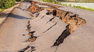
In September 2019, with epicentre the near India- Pakistan border an earthquake of 6.3 magnitude hit parts of North India alarm bells were rung in Himachal Pradesh. It sent tremors across several parts of Jammu and Kashmir, Punjab, Haryana and Rajasthan. It caused a lot of damage, from affecting roads in Mirpur with vehicles overturned and falling in gaps.
The Brief. Sign up to receive the top stories you need to know right now.